
MAPS & CHARTS. - Shop
Products In This Category:
-

- A CHART and VIEWS of PITCAIRNS ISLAND, 1784 - 1786
- £40.00
-

- A Chart of the Islands discovered in the Neighbourhood of OTAHEITE. 1784 - 1786
- £100.00
-

- A Chart of the North West Coast of AMERICA and North East Coast of ASIA, Explored in the Years 1778 & 1779.
- £90.00
-

- A Draught of BONTHAIN BAY Situated about 30 Leagues to the S.E. of MACASSAR in the ISLAND of CELEBES. 1784 - 1786
- £50.00
-

- A Plan of Success Bay in Strait Le Maire. 1784 - 1786
- £100.00
-

- A Plan of the Isle of Portland and parts adjacent 1710.
- £18.00
-

- A View of the N.W. Side of MAS-A-FUERA. 1784 - 1786
- £30.00
-

- Admiralty Islands. 1784 - 1786
- £80.00
-
- Anglesea. (Map) 1845.
- £10.00
-
- Bedfordshire. (Map) 1845.
- £12.00
-
- Brecknockshire. (Map) 1845.
- £11.00
-
- Caermarthenshire. (Map) 1845.
- £10.00
-
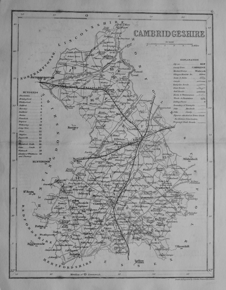
- Cambridgeshire. (Map) 1845.
- £12.00
-
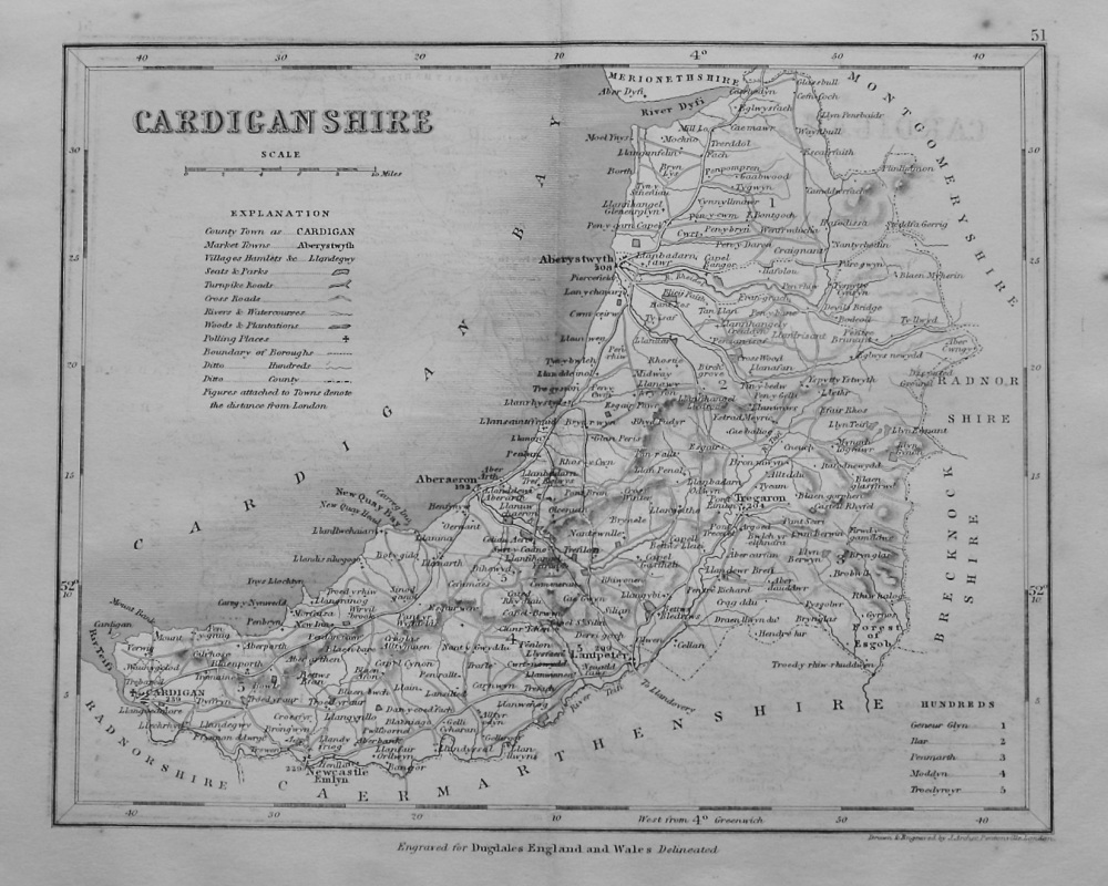
- Cardiganshire. (Map) 1845.
- £12.50
-

- CHART of COOK'S STRAIT in NEW ZEALAND. 1784 - 1786
- £70.00
-

- Chart of COOKS RIVER in the N.W. part of AMERICA 1784 - 1786
- £70.00
-

- CHART of NORTON SOUND and of BHERINGS STRAIT made by the East Cape of ASIA and the West Point of AMERICA. 1784-86.
- £70.00
-

- Chart of the FRIENDLY ISLANDS. 1784-86.
- £70.00
-

- Chart of the Island OTAHEITE by CAPT. COOK 1769..
- £30.00
-

- Chart of the SANDWICH ISLES. 1784 - 1786
- £250.00
-
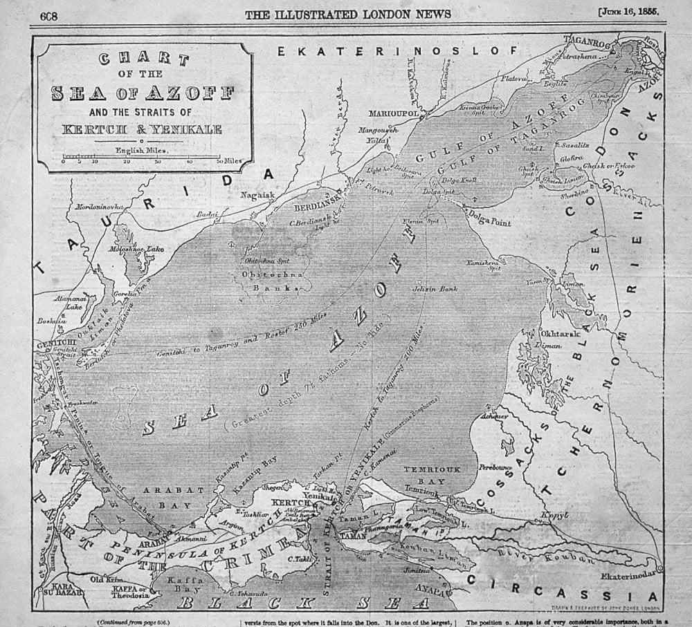
- Chart of the Sea of Azoff and the Straits of Kertch & Yenikale. 1855
- £10.00
-

- Chart of VAN DIEMEN'S Land. 1784-86.
- £40.00
-
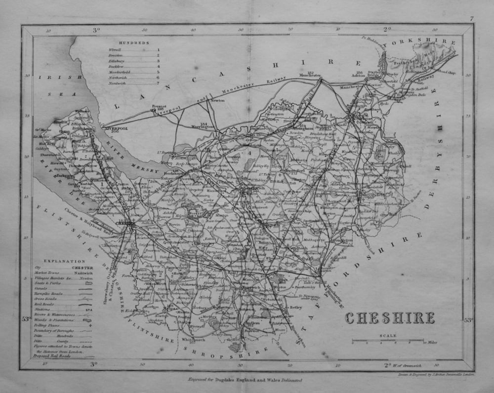
- Cheshire. (Map) 1845.
- £11.00
-

- Christmas Island Latitude 1°.58 N, Longitude 2 0° 2. . 2SE.. Discovered in the Ships Resolution and Discovery. 1777.
- £95.00
-

- Country Between Cairo and Suez Canal to illustrate military operations. 1882.
- £25.00