Customer Login / Register
-
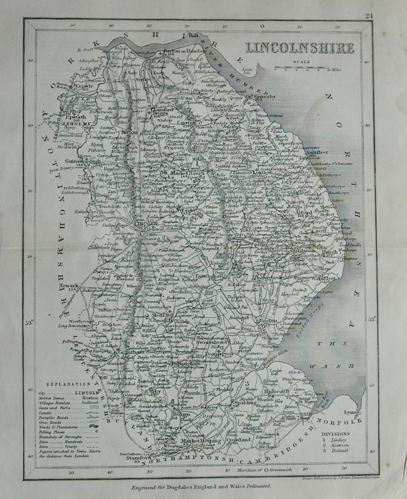
- Lincolnshire. (Map) 1845.
-
£9.00
-
- MAP - Environs of London - Windsor Castle to Gravesend - c1857
-
£180.00
-
- Map of European Russia shewing its Ealiest extent, its Encroachment upon Adjacent Countries, and the Present Boundary of The Empire. 1855.
-
£14.50
-
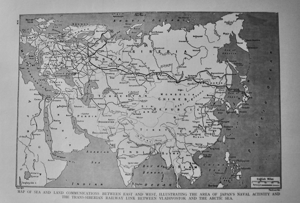
- Map of Sea and Land Communications between East and West, Illustrating the Area of Japan's Naval Activity and the Trans-Siberian Railway Link between
-
£11.50
-
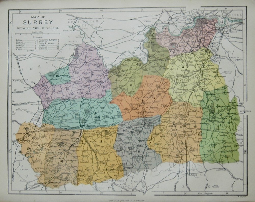
- Map of Surrey showing the Hundreds.
-
£35.00
-
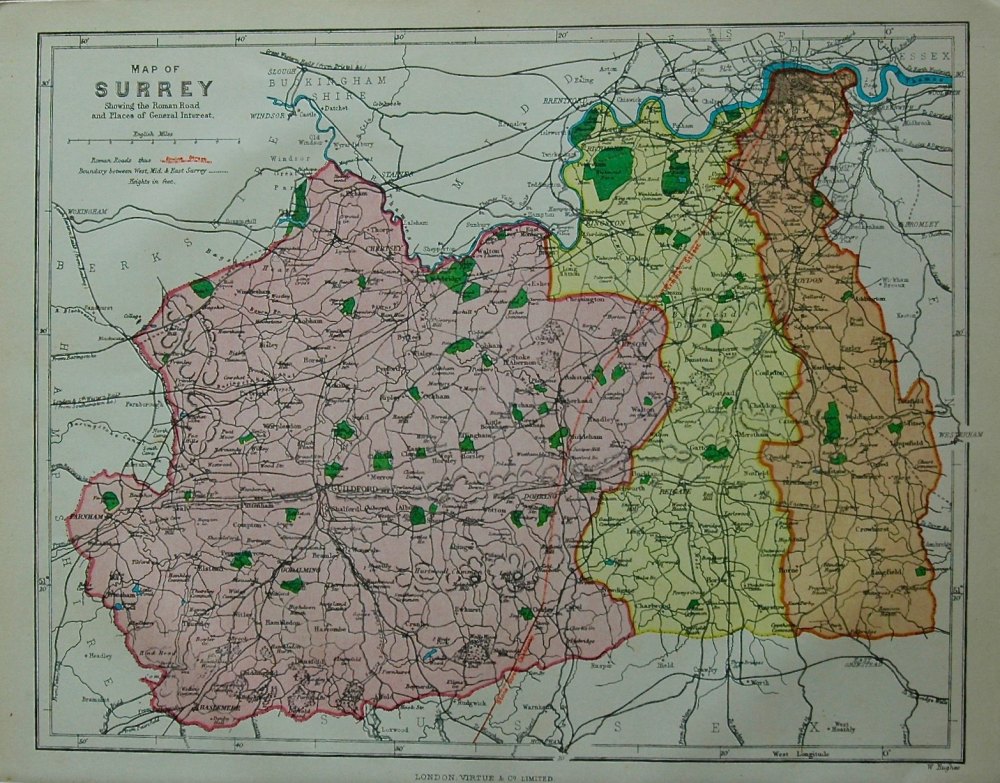
- Map of Surrey showing the Roman Road and Places of Interest. 1878c.
-
£35.00
-
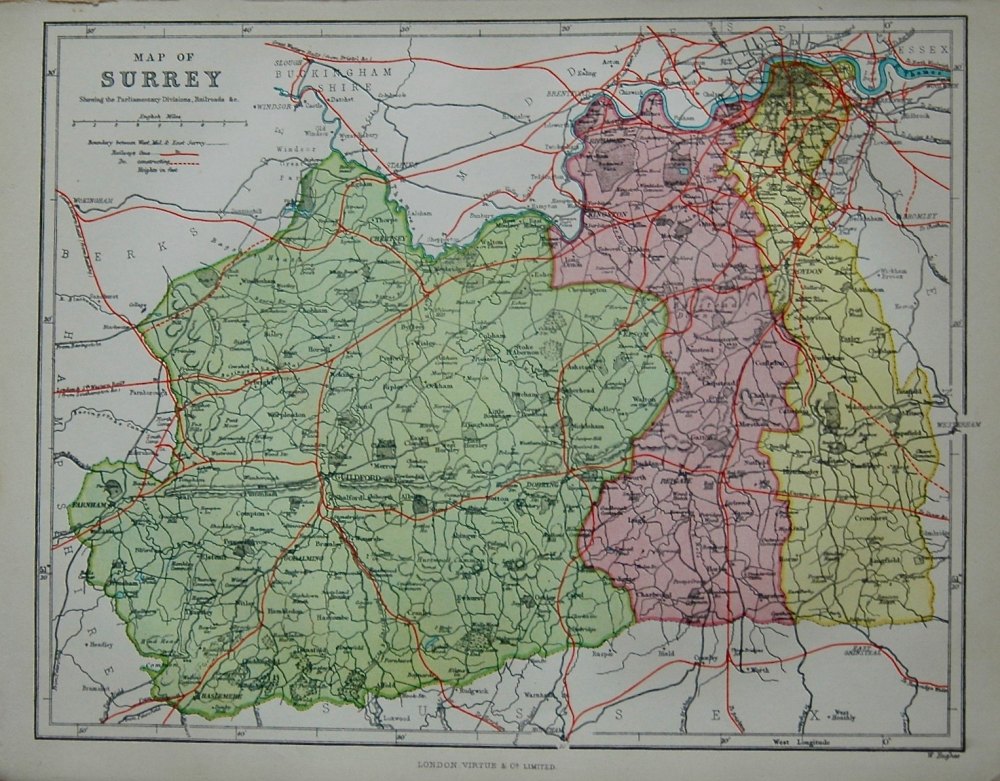
- Map of Surrey, showing the Parliamentary Divisions, Railroads & c.
-
£35.00
-
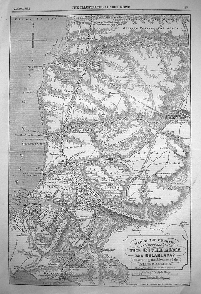
- Map of the Country between The River Alma and Balaclava, Illustrating the Advance of the Allied Armies. 1855
-
£14.50
-
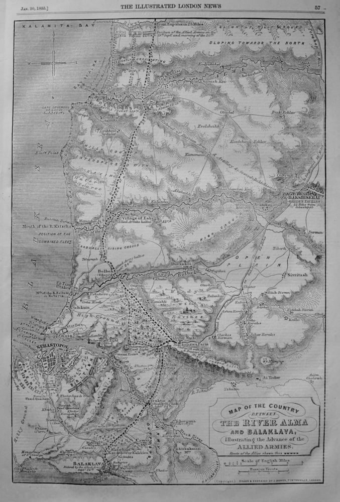
- Map of the Country between The River Alma and Balaklava, illustrating the Advance of the Allied Armies. 1855
-
£14.00
-
- Map of the Frontiers of Australia & Russia. 1856.
-
£12.50
-
- Map of the Great Western Railway, showing Cathedrals, Castles, & Abbeys. 1925.
-
£25.00
-
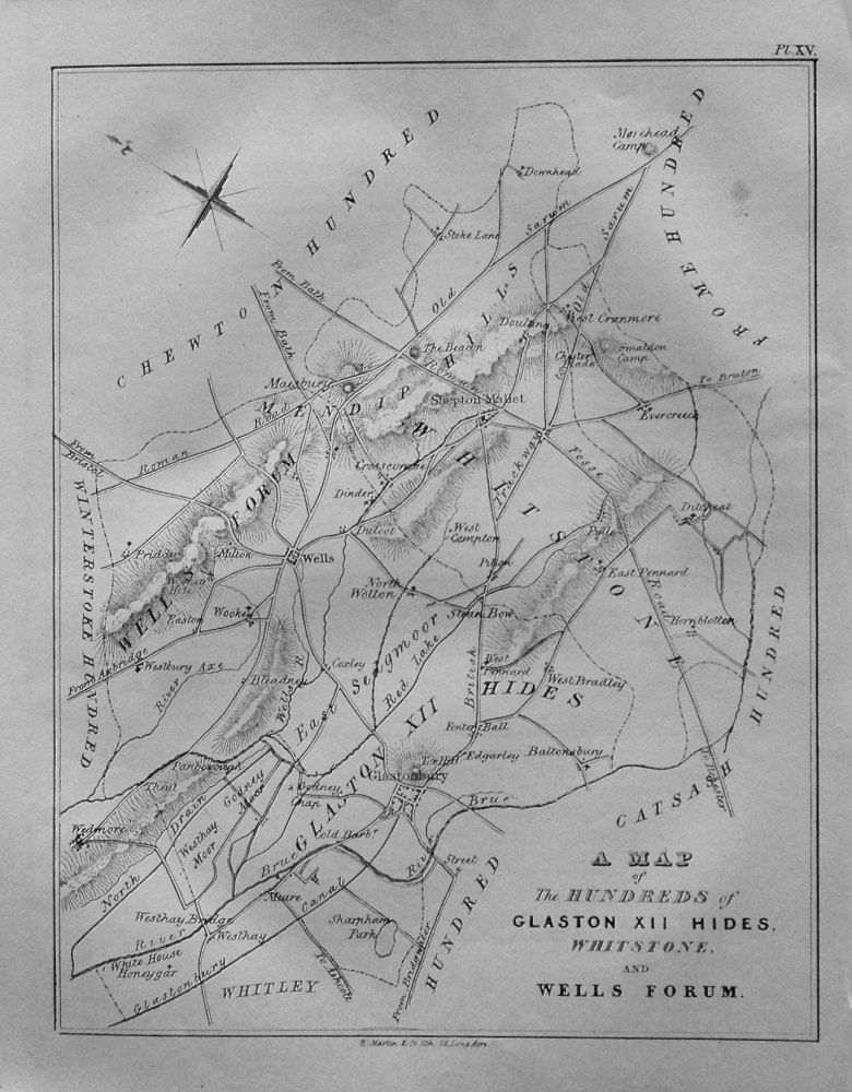
- Map of the Hundreds of Glaston XII Hides, Whitstone, and Wells Forum. 1839.
-
£15.00
-
- Map of the Seat of War in Virginia. 1863.
-
£12.00
-
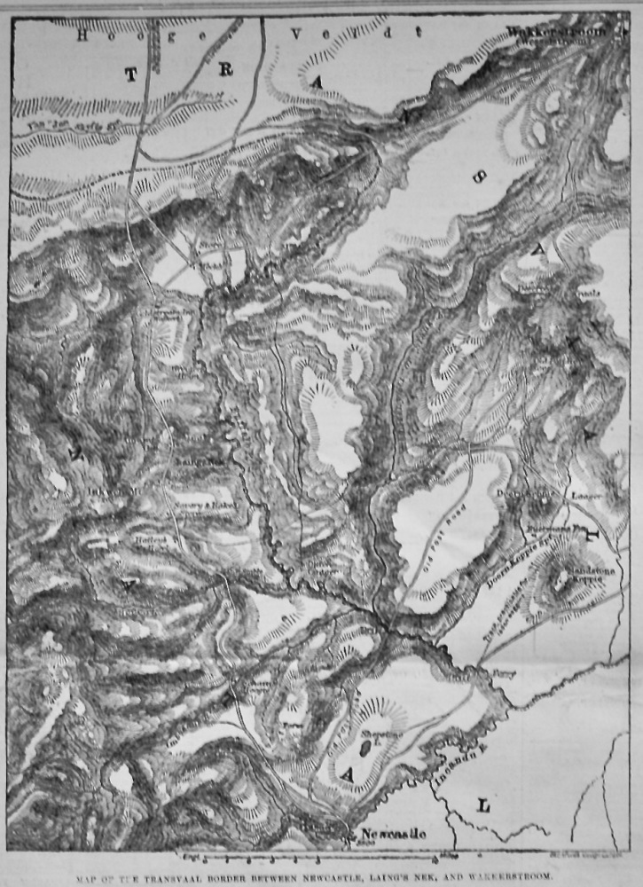
- Map of the Transvaal Border between Newcastle, Laing's Nek, and Wakkerstroom. 1881.
-
£12.50
-
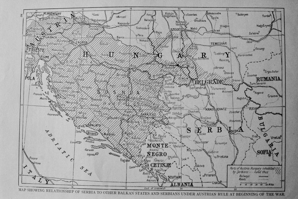
- Map Showing Relationship of Serbia to other Balkan States and Serbians under Austrian Rule at Beginning of War. 1914 - 1918.
-
£11.00
-
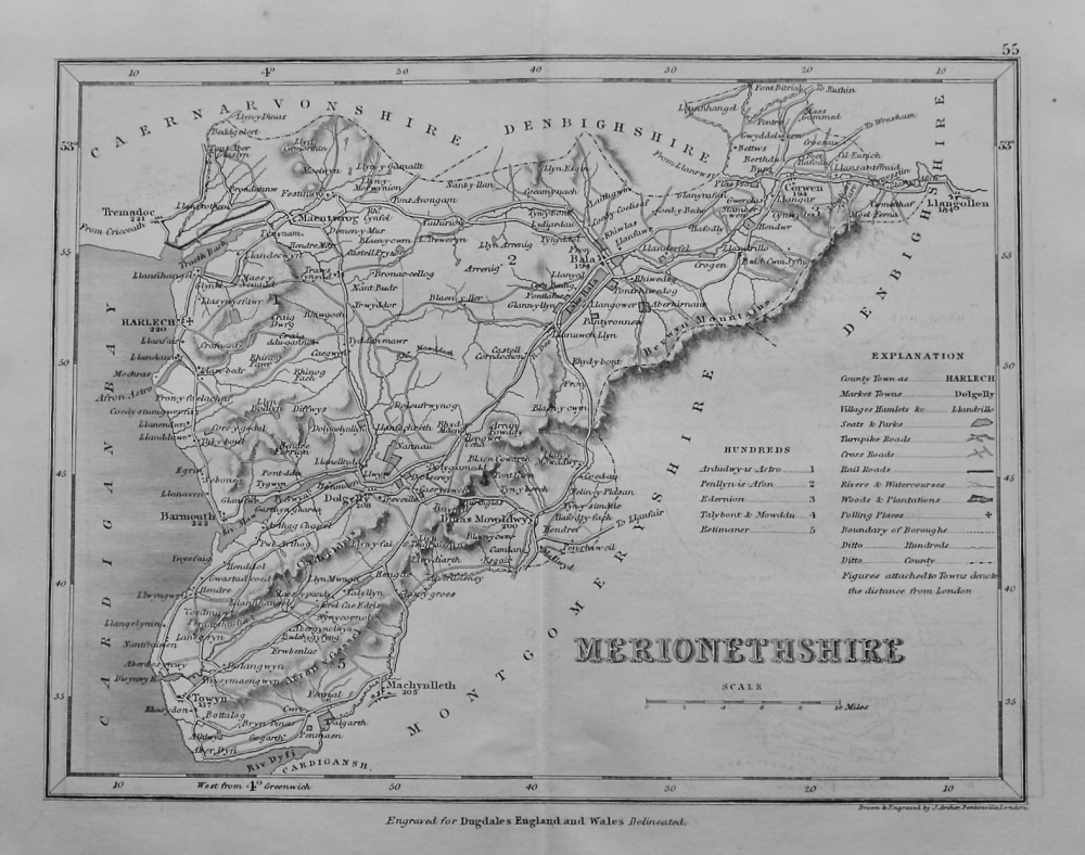
- Merionetshire. (Map) 1845.
-
£12.50
-
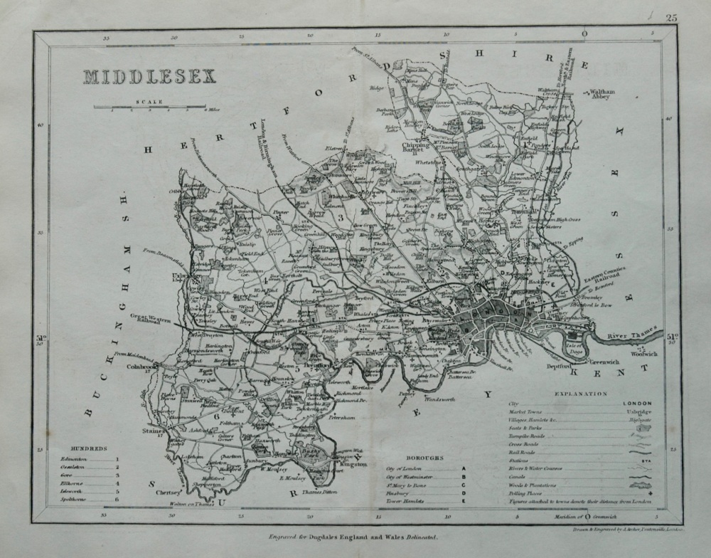
- Middlesex. (Map) 1845.
-
£12.50
-
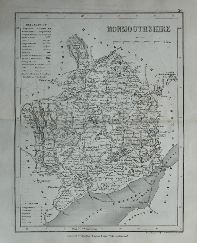
- Monmouthshire. (Map) 1845.
-
£12.00
-
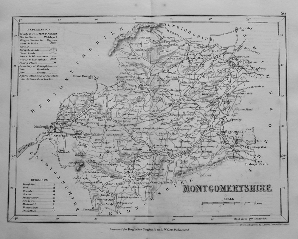
- Montgomeryshire. (Map) 1845.
-
£12.50
-
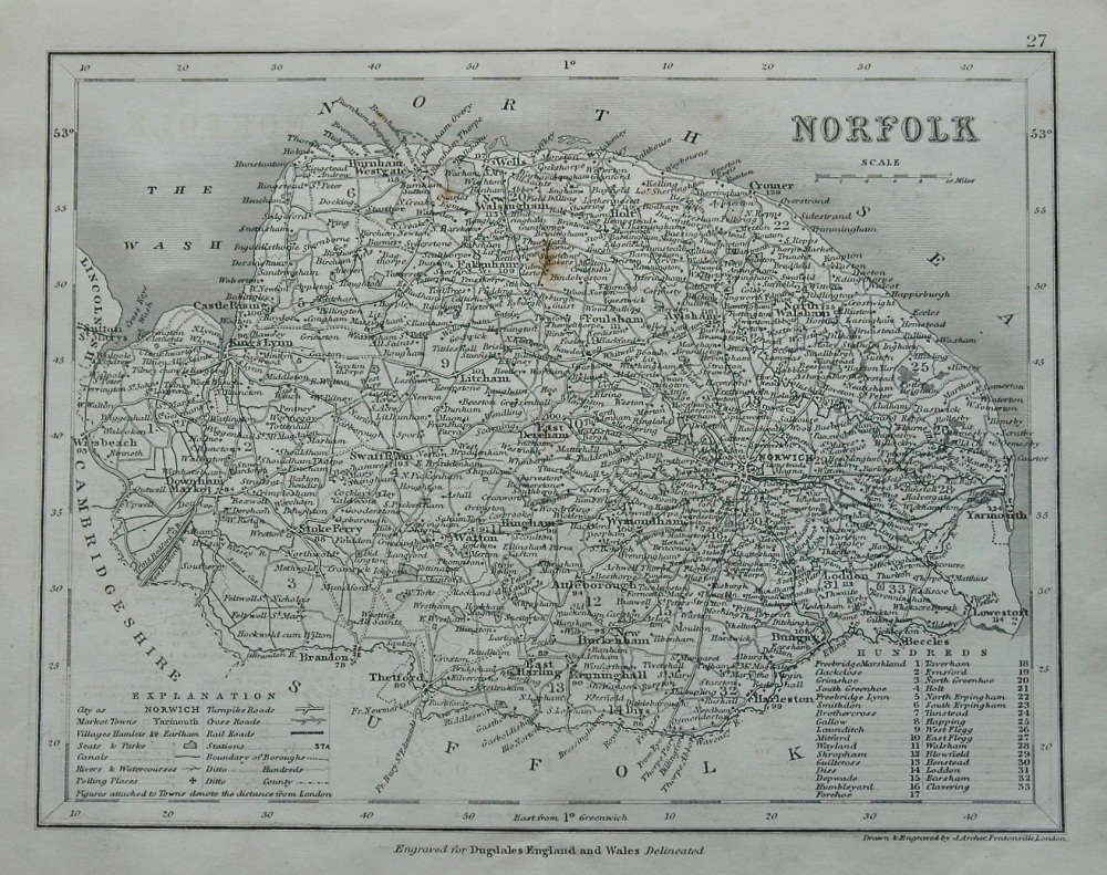
- Norfolk. (Map) 1845.
-
£10.00
-
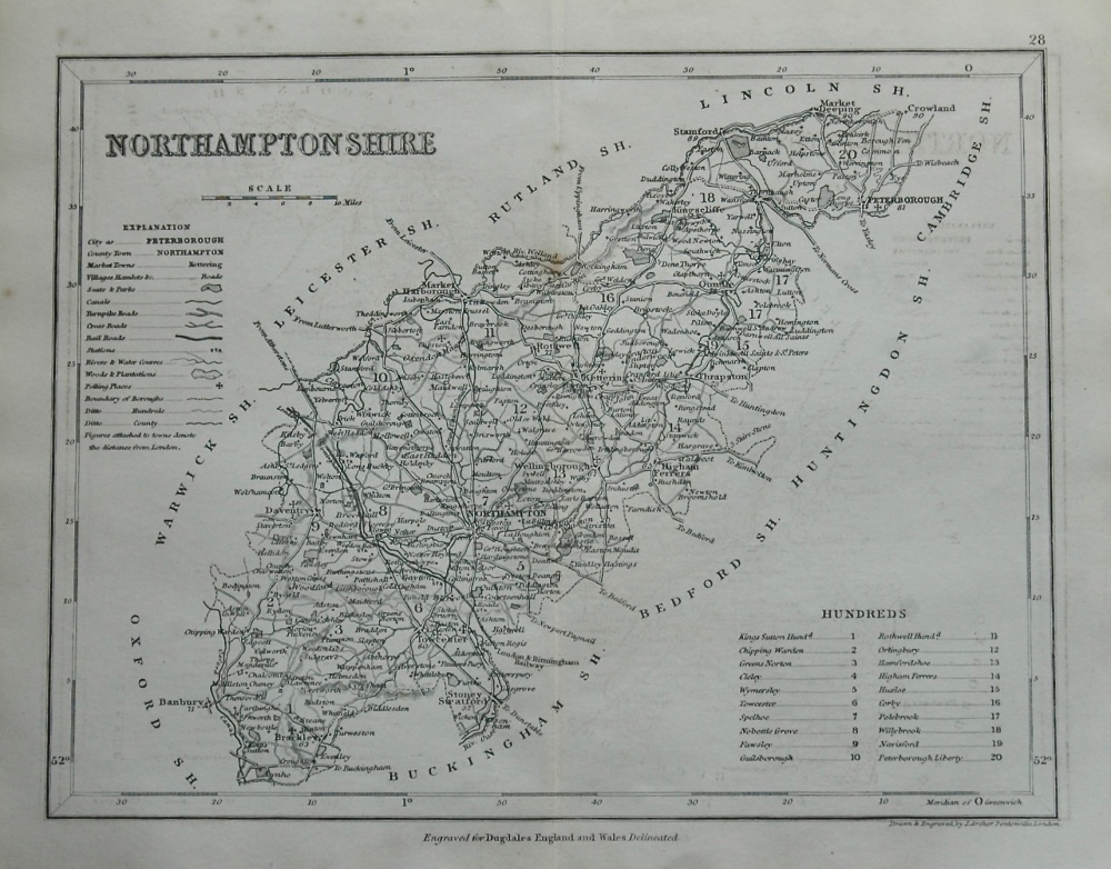
- Northamptonshire. (Map) 1845.
-
£12.50
-
- Northern Italy the Seat of War. 1859.
-
£14.50
-
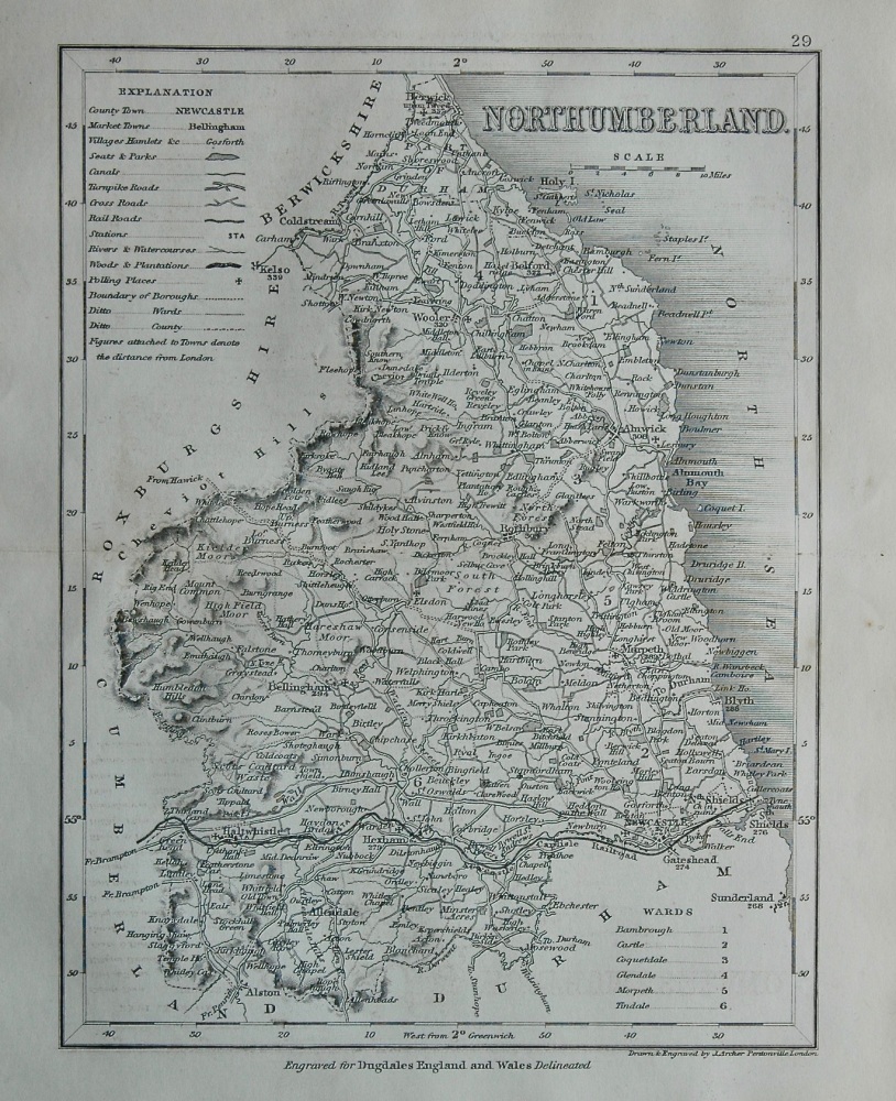
- Northumberland. (Map) 1845.
-
£12.50
-
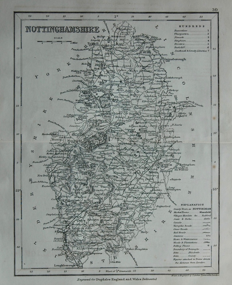
- Nottinghamshire. (Map) 1845.
-
£12.00
-
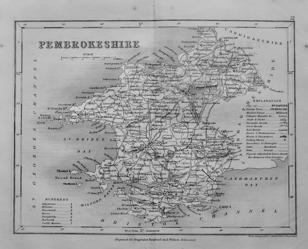
- Pembrokeshire. (Map) 1845.
-
£12.50